
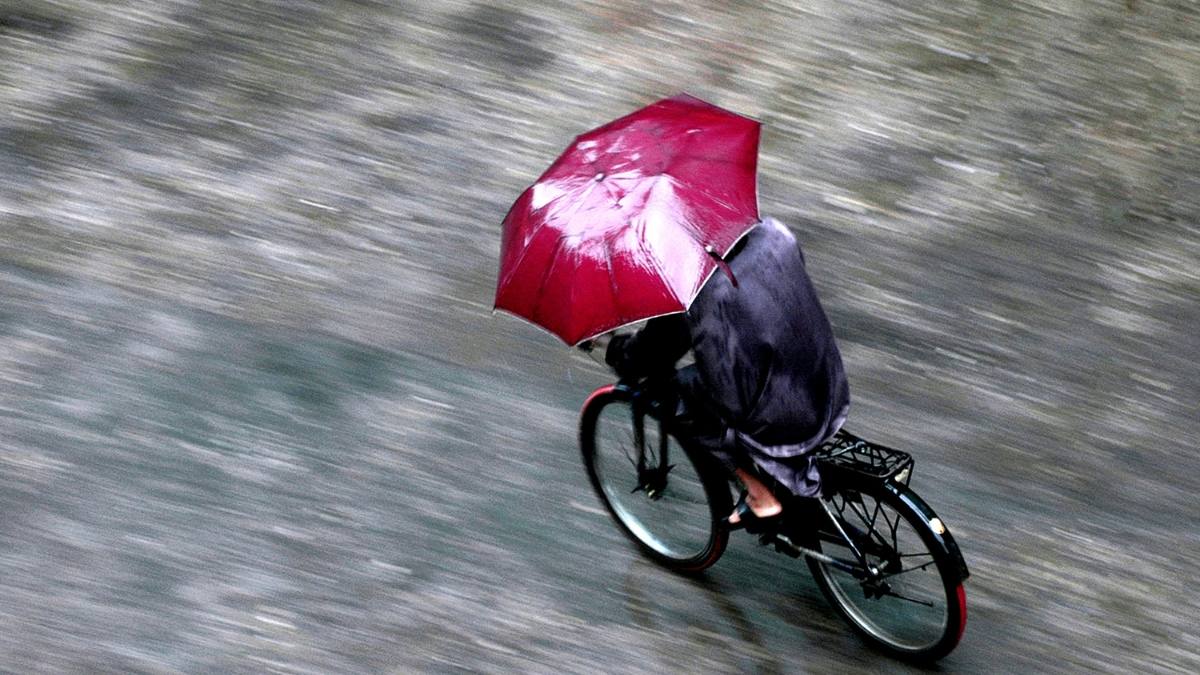
Unlock The Best Places In India To Visit During Monsoon
India, with its diverse landscapes and breathtaking natural beauty, offers a plethora of enchanting destinations to explore during the monsoon season. As the raindrops kiss the land, a mystical charm engulfs these places, transforming them into picturesque paradises. In this comprehensive guide, we will take you on a journey to the top nine monsoon destinations in India, each with its own unique attractions, rich history, captivating geography, and best ways to reach them. So, pack your bags and get ready to immerse yourself in the magic of the monsoons.
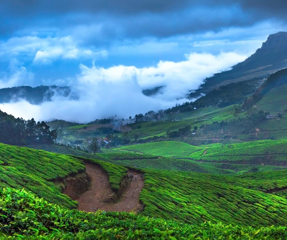
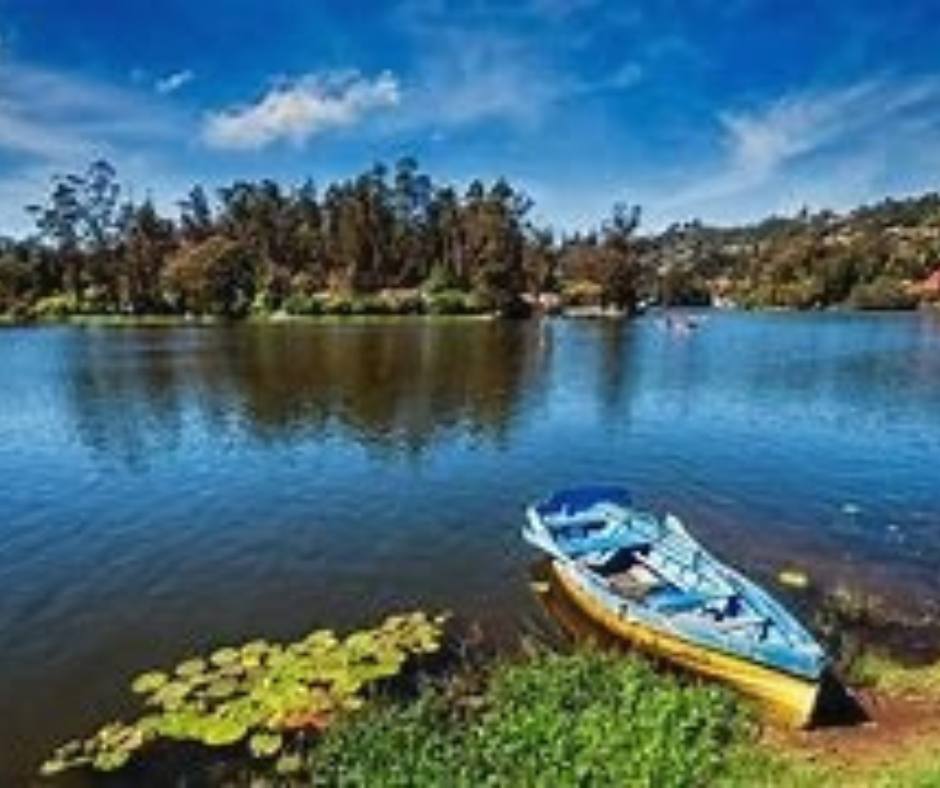
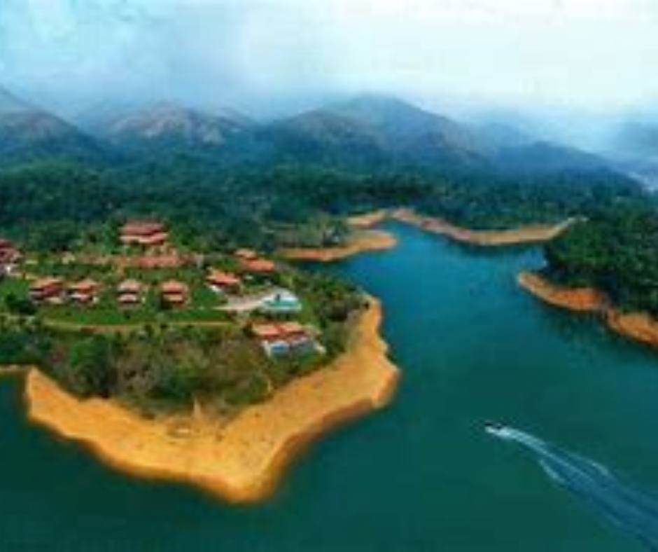
Munnar, Kerala: Where Nature Paints a Mesmerising Canvas
Special Attractions and Importance:
Nestled amidst the Western Ghats, Munnar is renowned for its lush green tea plantations, misty mountains, and cascading waterfalls. The town’s cool climate and tranquil surroundings make it an ideal getaway during the monsoons. Explore the Eravikulam National Park, witness the famous Neelakurinji bloom, and indulge in adventurous activities like trekking and paragliding.
History:
Munnar’s history dates back to the colonial era, when it served as a summer retreat for the British. The British planters recognised the region’s potential for tea cultivation and transformed it into a major tea-producing centre.
Geography:
Located in the Idukki district of Kerala, Munnar sits at an altitude of 1,600 metres above sea level. The town is surrounded by rolling hills, sprawling tea estates, and picturesque valleys. The convergence of three rivers—Mudhirapuzha, Nallathanni, and Kundala—further adds to its natural charm.
How to Reach Munnar:
- By Air: The nearest airport is Cochin International Airport, approximately 110 kilometres away. From there, you can hire a taxi or take a bus to Munnar.
- By Rail: The nearest railway station is Aluva, located about 110 kilometres away. From Aluva, you can hire a taxi or take a bus to Munnar.
- By Road: Munnar is well connected by road, and you can drive or opt for state-run or private buses from nearby cities.
Languages Spoken:
Malayalam is the primary language spoken in Munnar. However, English and Hindi are also widely understood and spoken by the locals.
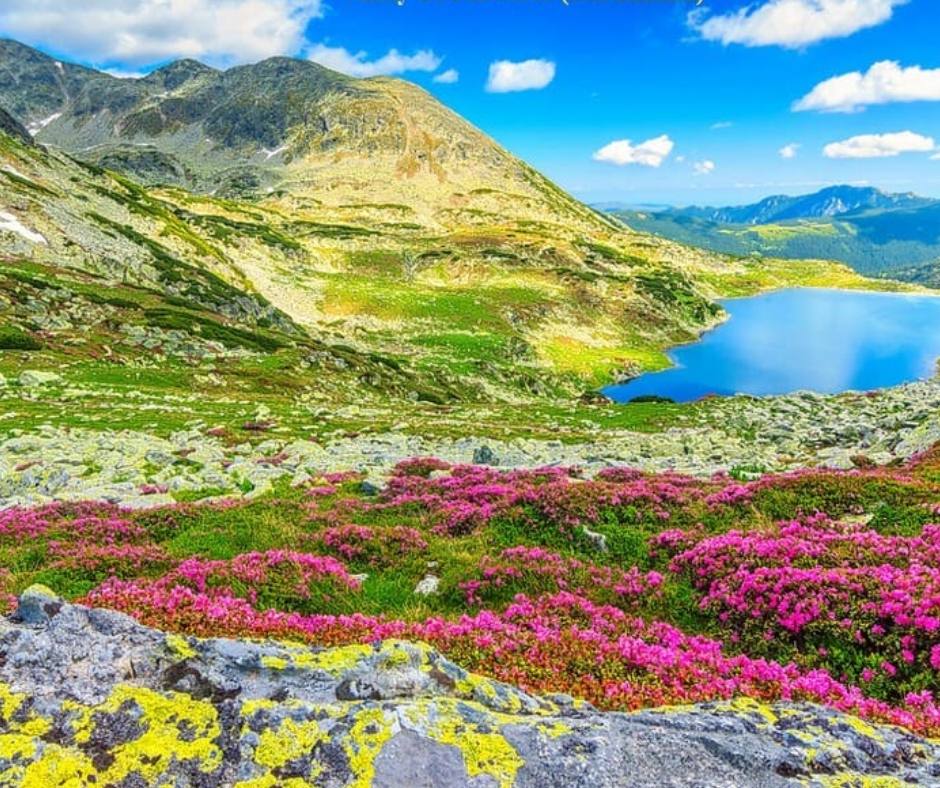
Valley of Flowers, Uttarakhand: Where Nature Unleashes its Colourful Symphony
Special Attractions and Importance:
The Valley of Flowers is a UNESCO World Heritage Site renowned for its vibrant meadows adorned with countless varieties of alpine flowers. During the monsoons, the valley transforms into a kaleidoscope of colours, offering a sight that is nothing short of magical. Explore rare floral species, go trekking in the Himalayas, and soak in the serene ambiance of this floral wonderland.
History:
The Valley of Flowers remained hidden from the world until 1931, when British mountaineer Frank Smythe stumbled upon it during an expedition. It was later declared a national park to preserve its unique flora and fauna.
Geography:
Situated in the Chamoli district of Uttarakhand, the Valley of Flowers lies within the Nanda Devi Biosphere Reserve. It is nestled in the western Himalayas at an altitude ranging from 3,250 to 6,750 metres. The valley is surrounded by towering snow-capped peaks, including Nanda Devi, the second-highest mountain in India.
How to Reach the Valley of Flowers:
- By Air: The nearest airport is Jolly Grant Airport in Dehradun, approximately 295 kilometres away. From the airport, you can reach the Valley of Flowers by hiring a taxi or taking a bus to Govindghat, the base camp for the trek. From Govindghat, you need to trek approximately 16 kilometres to reach the valley. It is advisable to hire a local guide for a safe and enjoyable trekking experience.
- By Rail: The nearest railway station to the Valley of Flowers is Rishikesh, located approximately 275 kilometres away. From Rishikesh, you can hire a taxi or take a bus to Govindghat and then proceed with the trek to the valley.
- By Road: The Valley of Flowers is well connected by road. You can reach Govindghat by taking a bus or driving from Rishikesh or other nearby cities. From Govindghat, you can begin your trek to the valley.
Languages Spoken:
The primary language spoken in the region is Hindi. However, due to its popularity among tourists, English is also understood and spoken by locals involved in the tourism industry.
Coorg, Karnataka: Where Misty Hills and Coffee Plantations Beckon
Special Attractions and Importance:
Coorg, also known as Kodagu, is a picturesque hill station famous for its mist-covered hills, lush coffee plantations, and cascading waterfalls. During the monsoons, Coorg comes alive with glistening greenery and a pleasant climate. Explore the Abbey Falls, visit the enchanting Dubare Elephant Camp, savour the flavours of Coorg’s renowned coffee, and indulge in thrilling activities like river rafting and trekking.
History:
Coorg has a rich history dating back to ancient times. It was ruled by various dynasties, including the Kadambas, Gangas, Cholas, and Hoysalas. The region played a significant role in the spice trade and later became a part of the British Raj.
Geography:
Located in the Western Ghats of Karnataka, Coorg is characterised by its rolling hills, dense forests, and meandering rivers. It sits at an average elevation of 900 metres above sea level, offering pleasant weather throughout the year.
How to Reach Coorg:
- By Air: The nearest airport is Mangalore International Airport, approximately 160 kilometres away. From the airport, you can hire a taxi or take a bus to Coorg.
- By Rail: The nearest railway station to Coorg is Mysore Junction, located around 120 kilometres away. From Mysore, you can hire a taxi or take a bus to Coorg.
- By Road: Coorg is well connected by road, and you can reach the hill station by driving or opting for state-run or private buses from nearby cities.
Languages Spoken:
The primary language spoken in Coorg is Kodava, which is a unique language with its own script. However, Kannada and English are widely understood and spoken by the locals.
Kodaikanal, Tamil Nadu: The Princess of Hill Stations
Special Attractions and Importance:
Kodaikanal, often referred to as the Princess of Hill Stations, is a charming destination nestled in the Palani Hills of Tamil Nadu. With misty mountains, serene lakes, and enchanting waterfalls, Kodaikanal offers a refreshing escape during the monsoons. Visit the beautiful Kodaikanal Lake, explore the picturesque Coaker’s Walk, admire the lush greenery of Bryant Park, and witness the breathtaking Silver Cascade Falls.
History:
Kodaikanal has a fascinating history that traces back to the early 19th century, when it was discovered by the British during their colonial rule. It served as a summer retreat for British officials and missionaries.
Geography:
Situated at an altitude of around 2,133 metres above sea level, Kodaikanal is characterised by its gentle slopes, wooded valleys, and meandering streams. The town is surrounded by dense forests and is located on the southern crest of the upper Palani Hills.
How to Reach Kodaikanal:
- By Air: The nearest airport to Kodaikanal is Madurai International Airport, located approximately 120 kilometres away. From the airport, you can hire a taxi or take a bus to Kodaikanal.
- By Rail: The nearest railway station is Kodai Road, situated at a distance of about 80 kilometres from Kodaikanal. From Kodai Road, you can hire a taxi or take a bus to reach the hill station.
- By Road: Kodaikanal is well connected by road. Regular bus services operate from nearby cities and towns, including Madurai, Coimbatore, and Chennai. You can also drive to Kodaikanal, enjoying the scenic beauty along the way.
Languages Spoken:
Tamil is the primary language spoken in Kodaikanal. However, due to its popularity among tourists, English is widely understood and spoken by locals involved in the tourism industry.
Shillong, Meghalaya: The Abode of Clouds
Special Attractions and Importance:
Shillong, the capital city of Meghalaya, is a breathtaking destination nestled in the lap of nature. Known for its mist-covered hills, cascading waterfalls, and vibrant culture, Shillong offers a unique experience during the monsoons. Explore the living root bridges in Cherrapunji, visit the picturesque Ward’s Lake, soak in the beauty of Shillong Peak, and immerse yourself in the local Khasi culture.
History:
Shillong has a rich history as the capital of the state of Meghalaya. It was originally the capital of the British-administered Assam Province and served as a hill station during the colonial era. After Meghalaya’s formation in 1972, Shillong became the capital of the newly-formed state.
Geography:
Situated in the eastern part of Meghalaya, Shillong is located at an average altitude of 1,491 metres above sea level. It is surrounded by rolling hills, deep valleys, and numerous lakes. The city experiences abundant rainfall during the monsoon season, adding to its natural beauty.
How to Reach Shillong:
- By Air: The nearest airport is Shillong Airport, also known as Umroi Airport, located approximately 30 kilometres away from the city centre. From the airport, you can hire a taxi or take a bus to reach Shillong.
- By Rail: The nearest major railway station to Shillong is Guwahati Railway Station, situated around 100 kilometres away. From Guwahati, you can hire a taxi or take a bus to reach Shillong.
- By Road: Shillong is well connected by road. Regular bus services operate from nearby cities like Guwahati and other parts of Meghalaya. You can also hire a taxi or drive to Shillong, enjoying the scenic beauty of the region.
Languages Spoken:
The primary language spoken in Shillong is Khasi. However, English is widely spoken and understood, making it easier for travellers to communicate.
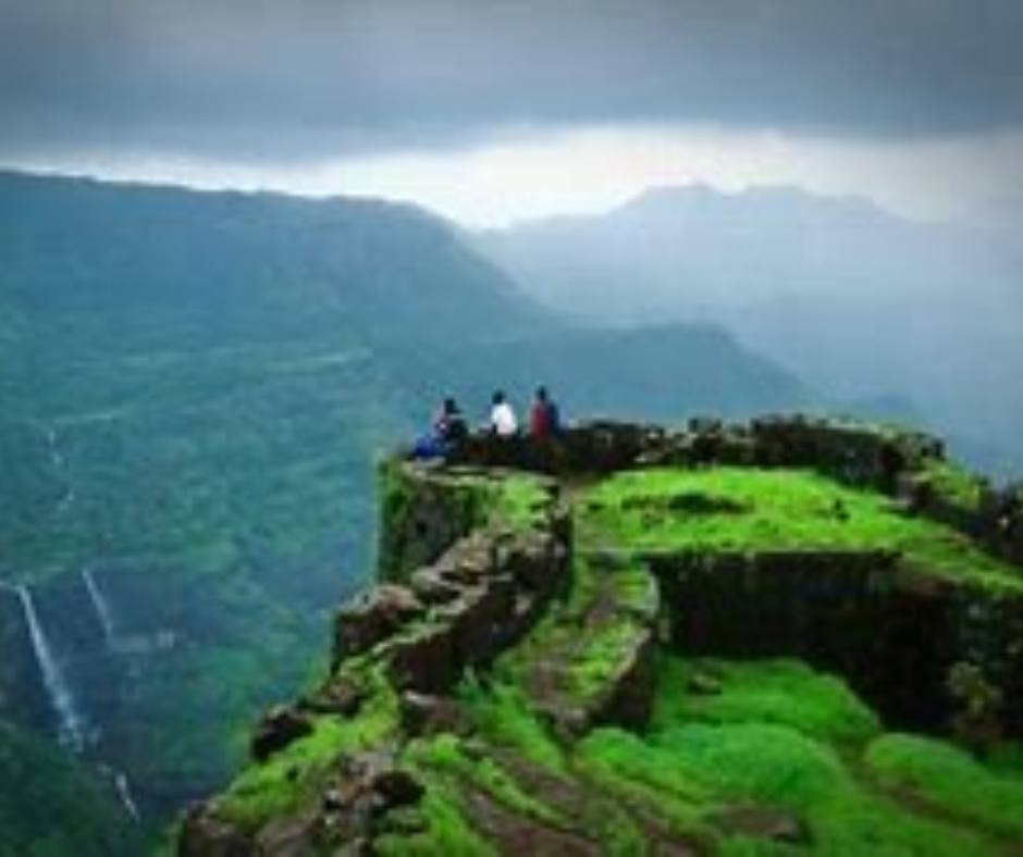
Lonavala, Maharashtra: Where Hills and Waterfalls Unite
Special Attractions and Importance:
Lonavala, nestled in the Sahyadri mountain range of Maharashtra, is a popular monsoon destination known for its lush greenery, misty hills, and magnificent waterfalls. The region offers a refreshing retreat with its pleasant weather and breathtaking landscapes. Explore the stunning Bhushi Dam, trek to the ancient Karla Caves, enjoy panoramic views from Tiger’s Leap, and indulge in local delicacies like chikki (a sweet snack) and vada pav (a popular street food).
History:
Lonavala has a rich historical background dating back to ancient times. It was ruled by various dynasties, including the Satavahanas, Rashtrakutas, and Yadavas. The region played a significant role during the Maratha Empire and later became a popular hill station under British rule.
Geography:
Located in the Sahyadri mountain range of the Western Ghats, Lonavala is surrounded by lush green valleys, dense forests, and cascading waterfalls. The town sits at an elevation of approximately 622 metres above sea level, providing stunning views of the surrounding landscapes.
How to Reach Lonavala:
- By Air: The nearest airport to Lonavala is Pune International Airport, situated about 65 kilometres away. From the airport, you can hire a taxi or take a bus to reach Lonavala.
- By Rail: Lonavala has its own railway station, which is well connected to major cities like Mumbai and Pune. Regular train services operate to and from Lonavala, making it easily accessible by rail.
- By Road: Lonavala is well connected by road and can be reached by car or bus. It is located on the Mumbai-Pune Expressway, making it easily accessible from both cities. State-run buses and private vehicles also operate regular services to Lonavala.
Languages Spoken:
The primary language spoken in Lonavala is Marathi. However, due to its popularity among tourists, Hindi and English are also widely understood and spoken by the locals.
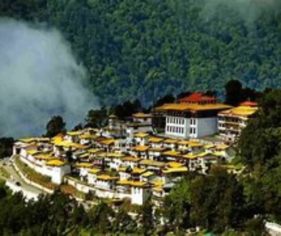
Tawang: Discover the Tranquil Beauty of the Himalayas
Nestled amidst the serene Himalayan ranges in the northeastern state of Arunachal Pradesh, Tawang is a breathtaking destination that captivates visitors with its untouched beauty and spiritual ambiance. This picturesque town is renowned for its monasteries, pristine lakes, and awe-inspiring landscapes.
Special Attractions and Importance:
Tawang is most famous for its grand Tawang Monastery, also known as Galden Namgyal Lhatse, which is the largest Buddhist monastery in India and the second-largest in the world. The monastery, built in the 17th century, holds immense religious and cultural significance for Buddhists. Its stunning architecture, vibrant prayer halls, and exquisite murals attract pilgrims and tourists alike.
Another significant attraction in Tawang is the majestic Tawang War Memorial, built to commemorate the martyrs of the 1962 Indo-China War. The memorial houses a museum that displays artefacts, photographs, and documents related to the war, offering a glimpse into the region’s history.
Geography and Climate:
Tawang is located at an elevation of around 3,048 metres (10,000 feet) above sea level, making it one of the highest inhabited regions in India. Surrounded by snow-capped peaks, lush valleys, and glistening lakes, the town presents a stunning panorama of natural beauty. The monsoon season brings abundant rainfall, which nourishes the verdant landscapes and adds to the region’s charm.
How to Reach Tawang:
- Reaching Tawang can be an adventure in itself due to its remote location.
- The nearest airport is Tezpur Airport, located approximately 317 kilometres away. From Tezpur, one can hire a taxi or take a shared jeep to reach Tawang. It is advisable to plan for a two-day journey with an overnight stay in Bomdila.
- Tawang is also accessible by road from Guwahati, the capital city of Assam. The distance between Guwahati and Tawang is approximately 521 kilometres, and the journey takes around 12–15 hours. Regular bus services and private taxis are available for this route.
Languages Spoken:
The local language spoken in Tawang is Monpa, which is also the predominant ethnic group in the region. However, Hindi and English are widely understood and spoken due to the influx of tourists.
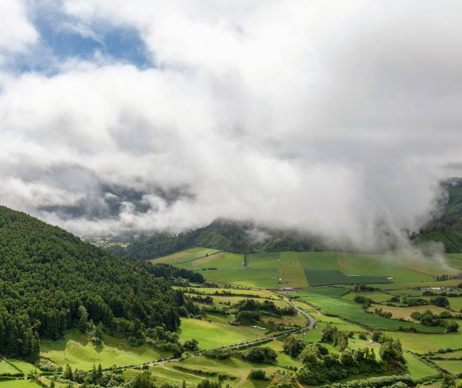
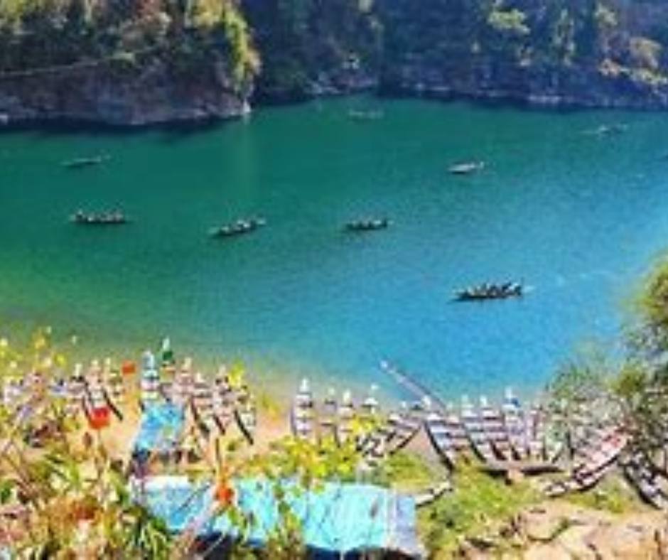
Wayanad: Exploring the Green Paradise of Kerala
Nestled in the Western Ghats of Kerala, Wayanad is a land of enchanting beauty and tranquility. Known for its lush green landscapes, mist-covered mountains, and rich biodiversity, this picturesque destination offers a serene getaway amidst nature’s embrace.
Special Attractions and Importance:
Wayanad is renowned for its wildlife sanctuaries, spice plantations, and breathtaking viewpoints. One of the must-visit attractions is the Wayanad Wildlife Sanctuary, home to a diverse range of flora and fauna, including elephants, tigers, leopards, and various species of birds. Exploring the sanctuary through guided jeep safaris and trekking trails is a thrilling experience for wildlife enthusiasts.
Another popular attraction in Wayanad is the breathtaking Chembra Peak. Trekking to the summit of this peak rewards visitors with panoramic views of the surrounding hills, mist-covered valleys, and a heart-shaped lake known as the Chembra Lake. The trek is a challenging yet rewarding adventure that takes approximately 3–4 hours.
Geography and Climate:
Wayanad is located at an altitude ranging from 700 to 2100 metres above sea level, providing it with a pleasant climate throughout the year. The region is blessed with a tropical monsoon climate, making it a perfect retreat during the monsoon season when the hills come alive with lush greenery and cascading waterfalls. The rainfall during this time adds to the region’s charm, creating a romantic and serene atmosphere.
How to Reach Wayanad:
- By Air: The nearest airport to Wayanad is Calicut International Airport, located approximately 100 kilometres away. From the airport, one can hire a taxi or take a bus to reach Wayanad. The journey offers scenic views as you traverse through the winding roads of the Western Ghats.
- By Rail: For those travelling by train, the nearest railway station is Kozhikode (Calicut) Railway Station. From there, you can avail yourself of regular bus services or hire a taxi to reach Wayanad.
- By Road: By road, Wayanad is well connected to major cities in Kerala and neighbouring states. Regular bus services operate from cities like Bangalore, Mysore, Kochi, and Ooty, making it easily accessible by road.
Languages Spoken:
The primary language spoken in Wayanad is Malayalam, which is the official language of Kerala. However, due to the popularity of the destination among tourists, English and Hindi are also widely understood and spoken by the locals.
India boasts a myriad of enchanting destinations that come alive during the monsoon season. Whether it’s the misty hills of Munnar, the vibrant blooms of the Valley of Flowers, the tranquil beauty of Coorg, the serene lakes of Kodaikanal, the lush landscapes of Shillong, the cascading waterfalls of Lonavala, the spiritual ambiance of Tawang, the green paradise of Wayanad, or the majestic charm of Mahabaleshwar, each place offers a unique experience that leaves a lasting impression.
Embrace the monsoon season and embark on a journey to these mesmerising destinations, where nature’s beauty is at its peak. Immerse yourself in the lush greenery, breathe in the fresh air, and witness the captivating landscapes that paint a picture of serenity and tranquility. These best places to visit in India during the monsoon season will undoubtedly create memories to cherish for a lifetime.
So, pack your bags, grab your raincoat, and get ready to explore the hidden gems of India as they come alive with the magic of the monsoon. Happy travels!


